
A Peru itinerary built around Machu Picchu alone is like visiting India and only seeing the Taj Mahal. The site deserves its reputation - it absolutely does - but Peru contains considerably more than one mountain with ruins on top. The Sacred Valley of the Incas, the floating islands of Lake Titicaca, the colonial gravity of Cusco, and Lima's coastal density all belong in the same 8-day conversation.
This Peru 8-Day Itinerary is structured in the sequence that the geography demands: arrive in Cusco first and acclimatise to 3,400 metres before you attempt anything physical. Travel through Sacred Valley Peru to Aguas Calientes by Vistadome train before reaching Machu Picchu on day four. Continue south for a Lake Titicaca tour before finishing in Lima. Every city in sequence, every experience earned.
Every booking link is embedded. Every hotel is pre-selected. The only thing that requires your own judgement is the altitude - and this itinerary is built around that fact from day one.
You Land in the Capital of the Inca Empire. Your Only Job Today Is to Breathe Slowly and Let the Altitude Lose.
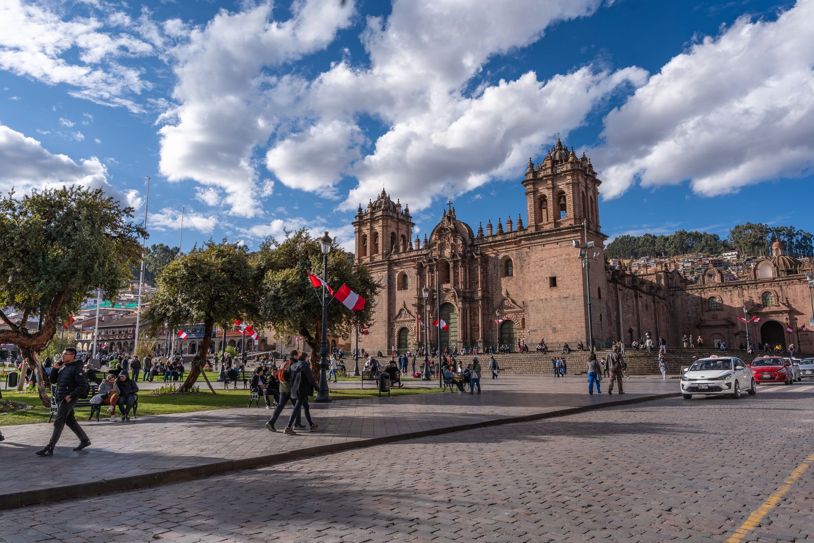
Your Cusco travel guide begins here. The first day is intentionally slow, giving you time to acclimatise to the city's 3,400-metre altitude while exploring the historic heart of the Inca capital at a comfortable pace.
Cusco was the capital of the largest empire in pre-Columbian America - the Inca empire at its peak controlled 2 million square kilometres from Colombia to Chile. The Spanish arrived in 1532, dismantled the Inca administrative structures, and built a colonial city on top of the Inca foundations, using the same perfectly-fitted stones that the Inca had cut without metal tools. The result is a city where every wall tells two stories simultaneously - and the lower story, in dark granite fitted together with no mortar to tolerances that a modern engineer would struggle to replicate, is always the more interesting one.
The arrival protocol for Cusco is non-negotiable: check in to the Novotel Cusco, drink coca tea (provided at the hotel, effective for mild altitude symptoms), eat a light lunch, and spend the afternoon at absolute rest. The evening city walking tour is gentle - the Plaza de Armas, the Cathedral, the Jesuit church of La Compañía de Jesús, and the Inca walls of Hatunrumiyoc where the famous 12-angled stone fits so precisely into its neighbours that a knife blade cannot be inserted between them. Walk slowly. This is not a pace suggestion. It is altitude management.
The Sacred Valley Is Where the Inca Grew Their Food, Built Their Fortresses, and Prepared You for What Comes Tomorrow.
The full-day Sacred Valley tour with buffet lunch is the correct second day - physically moderate, historically dense, and structured to move you from Cusco's altitude down into the valley before the Machu Picchu ascent. The Sacred Valley of the Urubamba River was the agricultural heartland of the Inca empire: the lower altitude and river irrigation made it possible to grow corn at elevations where corn normally cannot survive. The terraces at Pisac, cut into the hillsides at precise angles to capture sunlight and drain rainfall, are some of the most sophisticated pre-Columbian agricultural engineering on the continent.
Ollantaytambo is the afternoon stop - the only Inca village that has been continuously inhabited since the 15th century, with the original Inca urban grid still intact and functioning as residential streets. The Temple of the Sun at the top of the fortress is reached by climbing the same stone stairs the Inca built. The view from the top covers the full Sacred Valley in both directions. The Vistadome train departs from Ollantaytambo station - panoramic glass ceiling, narrated journey through the cloud forest, 1.5 hours to Aguas Calientes.
600 Years Ago the Inca Built a City at 2,430 Metres That No One Outside the Empire Knew Existed. Standing Inside It, You Understand Why They Kept It Secret.
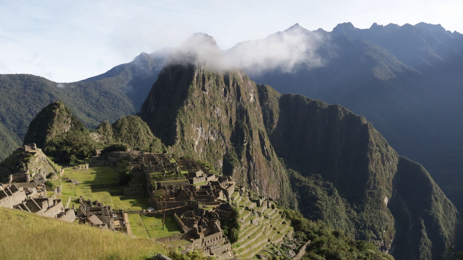
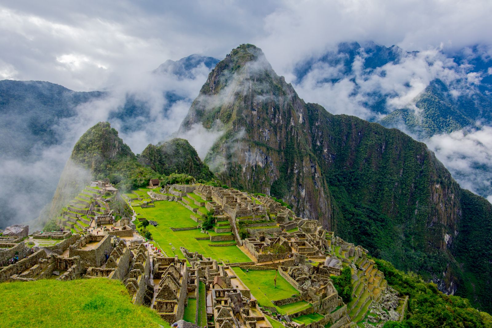
Machu Picchu was built around 1450 AD at the height of the Inca empire under the emperor Pachacuti. It was abandoned approximately 100 years later - historians believe due to the Spanish conquest disrupting the supply lines that kept it operational, though the Inca never mentioned it to the Spanish and the Spanish never found it. It remained unknown to the outside world until 1911, when Hiram Bingham, a Yale historian following local rumours, climbed the ridge and found it beneath centuries of jungle growth. The clearing took decades. The full extent of the site was not understood until satellite imaging in the 2000s.
The guided tour covers the highlights in a sequence designed to reveal the site's logic: the agricultural terraces on the southern slope (built to feed a population of 750 permanent residents and thousands of visitors), the Temple of the Sun (aligned to the June solstice sunrise with an accuracy that required no instruments beyond observation and stone), the Intihuatana stone (a carved granite pillar whose shadow marks astronomical events with precision), and the residential district where the stone walls still stand to their original height. Your guide translates the engineering into the social structure - who lived where, who worked what, and why this particular ridge, at this particular altitude, surrounded by cloud forest on three sides and a near-vertical drop on the fourth, was chosen as the site for a royal estate that the empire's entire population was organised to supply.
The Vistadome train returns to Ollantaytambo in the late afternoon, with a private transfer back to the Novotel Cusco for the final two nights in the city. Dinner at the hotel. The walk today is 3–4 kilometres across uneven stone - comfortable boots, not sandals, are not optional.
The Road from Cusco to Puno Crosses the Altiplano at 3,800 Metres. The Landscape Has No Reference Point for Anything You Have Seen Before.
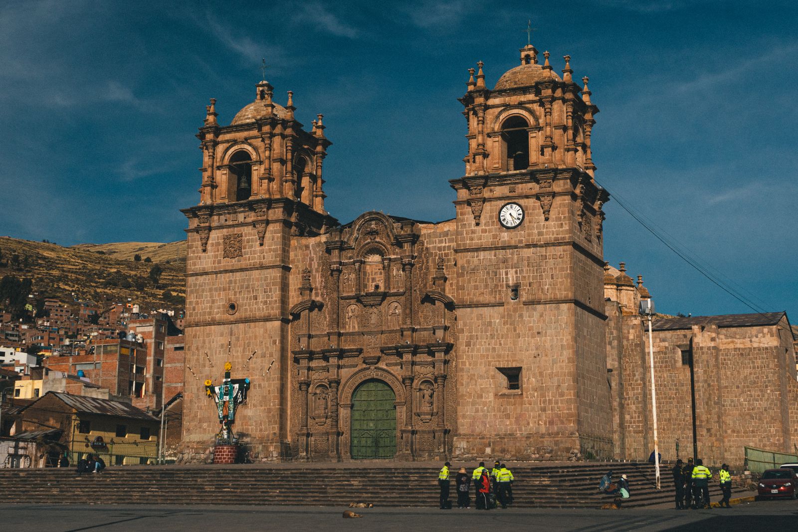
The bus from Cusco to Puno covers 388 kilometres across the Peruvian altiplano - the high plateau between the Andes ranges that sits between 3,500 and 4,500 metres above sea level. The landscape is unlike anything in Europe or South Asia: flat, treeless, ochre-coloured grassland running to the horizon in every direction, punctuated by Andean villages, grazing alpacas, and the occasional colonial church built by Spanish missionaries who chose the most remote places they could find to make their conversions permanent.
The journey includes a lunch stop at Sicuani town, and the full crossing takes approximately seven hours. Arrival in Puno is the late afternoon. The Hotel Jose Antonio Puno sits outside the city centre on the Carretera Puno-Desaguadero with lake views - the correct orientation for a hotel in a city that exists entirely because of the water beside it. Dinner at the hotel. Rest. Tomorrow is on the lake.
The Uros Have Been Living on Floating Reed Islands Since Before the Inca Existed. The Lake Beneath Them Is the Highest Navigable Body of Water on Earth.
Lake Titicaca sits at 3,812 metres above sea level, covers 8,372 square kilometres, and is shared between Peru and Bolivia. It is the highest navigable lake on earth - meaning large vessels can operate on it, which makes it unique among high-altitude bodies of water. The Inca considered it sacred, the place of origin of their creation mythology: the first Inca, Manco Cápac, was said to have emerged from the lake's waters to found the empire.
The Uros, Taquile and speedboat tour covers the two primary island experiences in a single full day. The Uros floating islands are the first stop: artificial islands constructed from the totora reed that grows throughout the lake's shallows, inhabited by the Uros people who have lived on floating platforms since before the Inca arrived - a deliberate strategy to remain independent of the empires that controlled the surrounding land. The islands float. They are anchored, not fixed. The ground beneath your feet moves. The Uros guide explains the construction, which requires continuous maintenance - new reeds added to the top as the bottom layer rots, the island literally consuming itself and regenerating simultaneously.
Taquile Island follows: a natural island 45 kilometres from Puno, inhabited by Quechua-speaking communities who have maintained their textile tradition - UNESCO-recognised as intangible cultural heritage - for centuries. The men knit. The hats they produce communicate social status, marital status, and community role through colour and pattern in a visual language that has no alphabet. The island has no cars, no hotels, and exactly one restaurant at the top of a long stone staircase. Lunch there. The view of the lake at 3,950 metres from the restaurant terrace is the highest meal you will eat on this itinerary.
Lima Is at Sea Level, Has 11 Million People, and Has Nothing in Common With the Previous Five Days. That Is Exactly Why It Belongs at the End.
The flight from Puno to Lima connects through another airport - confirm your routing and allow adequate transit time. You descend from 3,800 metres to sea level in under two hours. The physical relief is immediate. Your body, which has been working harder than normal for five days at altitude, suddenly has access to full oxygen pressure. Most travellers describe the first deep breath at sea level in Lima as one of the more notable physical moments of the trip.
The Lima 360° Panoramic Bus city tour runs from the airport arrival and covers the essential geography of the capital: the historic centre around the Plaza Mayor (a UNESCO World Heritage Site containing the Government Palace, the Cathedral, and the Archbishop's Palace in a single colonial square), the Miraflores clifftop district overlooking the Pacific Ocean, and the Larco Museum - the finest pre-Columbian collection in Peru, housed in a colonial mansion in Pueblo Libre, with 45,000 artefacts spanning 5,000 years of Peruvian civilisation.